Residential Land Use and Housing Development in Indonesia
Introduction:
This PhD research targets to find the solution for housing development in Indonesia to achieve sustainable Urban Form through land use control on residential land use. Start from the review on the spatial planning in Indonesia, this PhD dissertation introduces the spatial planning system in Indonesia and its implementation in Surabaya city. Further, we focus on traditional life style, this research attempts to present the adaptability of dwellers to arrange their house.
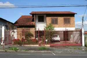
Dwellers tend to adjust their spatial setting in order to accommodate domestic activities. We have studied a settlement area which has kampong characteristics by strong Javanese influence. There are several individual variations and differentiations in the area, especially on the function of rooms and the implications on spatial arrangement. Javanese cultural characteristics are mostly unchanged. This part discusses a study about Javanese perceptions of rooms in the house and their perceptions of the flexibility of the rooms.
The strength of tradition supports the element of stability from one generation to another. In the case of housing pattern where traditions will generally be passed on to the next generation, we use vernacular approach. Tradition is still maintained when utilizing the home as a Home-based Enterprise (HBE). HBE developments are based on a family’s economic growth rate and their living needs. In homogeneous houses, it appears that there is vernacular activity in building or repairing homes. As an example, in the case of HBEs, housing activities are maintained during the process of urban growth.
Use of Residential Land:
Houses need to be expanded according to the needs of livings and business activities within a limited Residential Land. In this research the pattern of house development based on vernacular HBEs, encompassing both living activities and business activities, has been investigated. In the scope of Land Use Zoning (LUZ) is necessary to control the housing development in residential land use. In the case of The LUZ in Indonesia, there is not enough categories in determining the different types of land use for residential use.
Objectives:
Based on the problems above, this dissertation has some objectives to give the solution, there are:
1. Determining on flexibility of rooms to support housing development and explain the decision of spatial arrangement in the house in the urban area.
2. The pattern of house development based on vernacular HBEs Houses need to be expanded according to the needs of living and business activities within a limited urban area.
3. A clear line between different types of residential use is suggested in order to provide a basis for planners and developers in the construction of project based housing without disturbing the home owner-based housing for a sustainable urban form.
Spatial Planning System:
Indonesian Government is composed of 34 provinces, 511 in cities levels and 79,702 villages. At each level of local government has the authority to regulate their respective regions (social and economic) in accordance with the National Development Planning System Law and spatial planning in accordance with the Spatial Planning Act, then any development in this country based on plans have been made in each area.
Green City Design Approach for Global Warming Anticipatory:
The increasing number of the world’s urban population will increase very significantly. According to Schell and Uljaszek (1999) about 67% of the world’s population is expected to live in cities by the year of 2025. Urban development is a logical consequence of the urbanization process. The following effect of urban population growth is the increasing number of physical facilities and rapid development of the city; Due to rapid urbanization, natural ecosystems progressively replaced by urban land use.
Planning Issue in Urbanization Process:
Surabaya’s development plan attempts to find solutions of various planning issues in its urbanization process. Integrated spatial patterns between the city center (urban) and the suburbs (suburbs), between Surabaya with the surrounding area, supports the function as service centers in Surabaya Metropolitan Area context and Germakertasusila (Gresik, Madura, Mojokerto, Surabaya, and Sidoarjo Regency). As an indirect result of the high intensity of land use, the conversion of land can’t be avoided. The challenge is the increasing conversion of agricultural land use or land change function of cultivated area. Zoning for urban green space is largely determined in the Eastern region city of Surabaya
Green City Design in Ecological System of Surabaya:
Ecological System:
According to Diamantini and Zanon (2000), the new ecological indicators should be developed for urban planning for sustainable development. Comparison between the areas of green open space can assess the quality of urban planning, although it can’t reflect the quality of green open space. As the research conducted by Dyer (1994), he stated that the limits of various plant species can change dramatically due to climate warming, triggered by the release of greenhouse gases in the future. In this case, Surabaya City is a center of the Eastern Indonesia development.
Toward green city design: spatial structure and patterns:
In accordance with the laws of spatial No. 26 of 2007, the development of Surabaya city should refer to the long-term development plans of national, provincial and city of Surabaya for ensuring the proportion of green open space. In the design of long-term development plan of the town which contained 8 Surabaya’s development missions. One of the Surabaya’s urban development missions is making environmentally spatial planning and put its orientation to the principles of equitable and sustainable way to achieve the eco-city Surabaya.
Discussion of Surabaya`s Planning Practice:
In Surabaya’s development plan, an ecological approach to urban planning became a very important approach in anticipating global warming. Approach to effective functioning of open space (ecological, social and economic) into new approaches was taken into account in Surabaya’s development plan. Effective use of urban space becomes a challenge in implementing the concept of green city design in this city. The city should be viewed as an ecosystem of dynamic interaction between social life community and nature environment, which becomes a major mindset in urban planning and design approach.
Conclusion:
Through investigating the informal housing vernacular pattern occurring in the process of urban growth, Kampong Sanan has homogeneity as a village that produces and sells “tempe”. Residents build houses in accordance with their economic level and the location of their home.
A research approach focusing on vernacular patterns is essential in order to know more about the needs and traditions of housing development and use of residential land. The questionnaire was an instrument in tracking and analyzing the patterns of house development as vernacular patterns; investigation in the case study area is useful to obtain detailed information on the changes, the motivation to do renovations, and the expectation of available funds to build.